Invisible-5
Invisible-5 is a free, downloadable, 23-track self-guided audio tour by car investigating stories of people and communities fighting for environmental justice along California’s I-5 corridor between San Francisco and Los Angeles through oral histories, field recordings, found sound, recorded music and archival audio documents.
Interstate-5
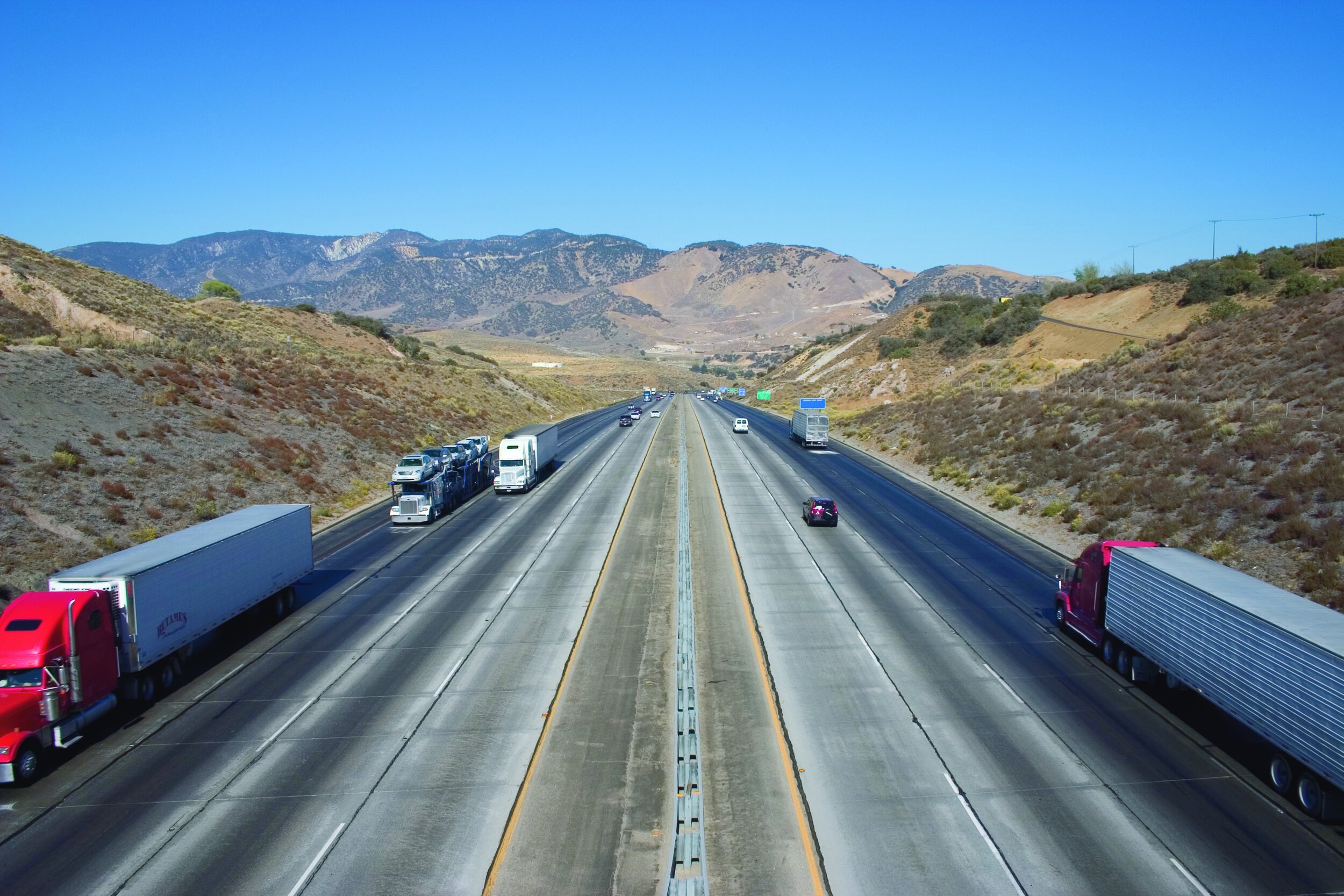
The I-5 is a critical pathway along the west coast for trade, tourism, and migration, and functions as part of the infrastructure bundle that parallels it - supporting symmetrical movements of water, oil, and gas. Running along the San Joaquin Valley's west side, the I-5 is also vital for intermodal shipping, intensive ranching, farming and dairying, new housing development, waste dumping and the gas and oil industry.
And Interstate-5 is an "Intermodal Corridor of Economic Significance" - a category of freeway "corridors that are most essential to the California economy in terms of national and international trade," as defined by California Streets and Highways Code, Division 3, Chapter 4.7. As California's major north-south highway connecting the state's urban hubs - San Francisco and Los Angeles - the 5 is usually driven at high speed. Invisible-5 travels the invisible toxic landscape of the I-5 corridor, of pesticide drift, hazardous waste dumping and incineration, groundwater contamination, oil extraction, and large-scale dairying.
Experienced as a blur, few drivers realize the spare, majestic landscape along the I-5 corridor is polluted. Often, there is little to see, smell, or taste of the mostly invisible pollutants: benzene and perchlorate in the water, dioxin and PM2.5 in the air. For residents along the I-5 corridor, often these manifest as just a hazy sky, a faint odor, or the sense that something tastes different about the water.
But as much of the pollution is transient, many of the tour's sites are fugitive. The movement of traffic along the I-5 itself creates a river of moving air, where sprayed pesticides mix with diesel emissions, creating a moving stream dense with small particulate matter.
Political-5
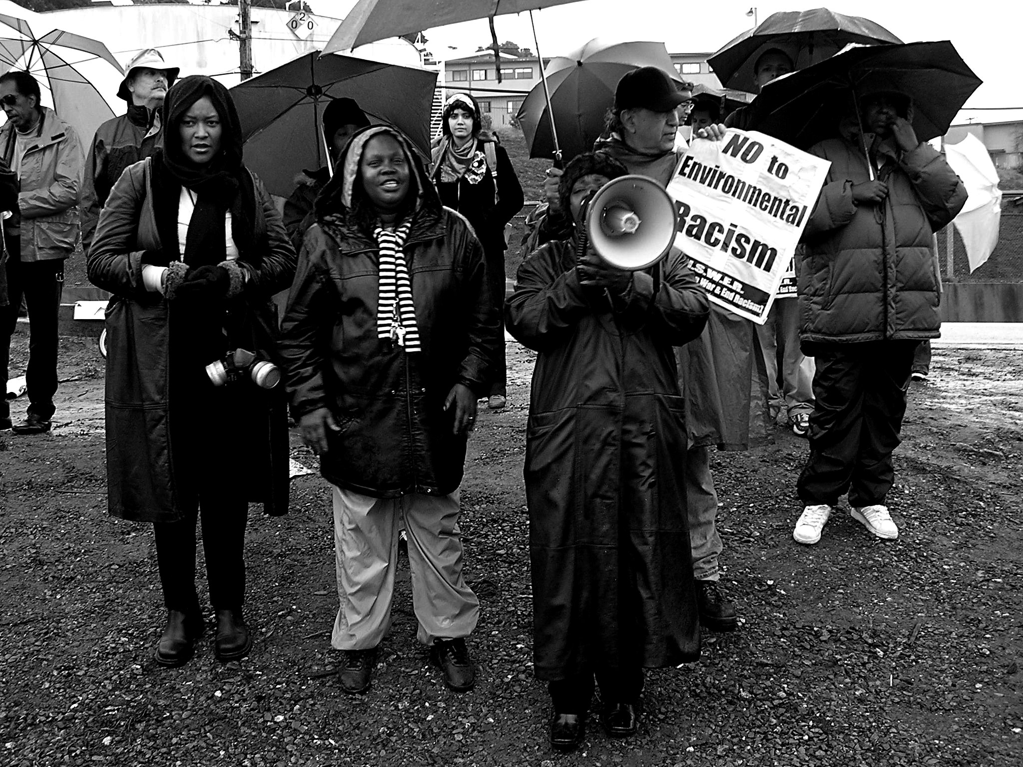
Invisible-5 examined why polluting industries and businesses are often sited near poor, rural and inner-city communities of color in California, through oral histories of people fighting for environmental justice along the I-5. The communities in the San Joaquin Valley along the I-5 are often hidden just out of sight of the freeway, where easy truck access moves toxic waste to landfills through small towns like Patterson, Kettleman City, or Buttonwillow. In the areas around San Francisco and Los Angeles, communities sit directly under or adjacent to the I-5, with homes, playgrounds, and schools just yards from the freeway.
Collaborators
Invisible-5 was produced in 2006 by Amy Balkin in collaboration with Kim Stringfellow, Tim Halbur, Greenaction for Health and Environmental Justice, and Pond: Art, Activism and Ideas (Marisa Jahn/Steve Shada), with support from the Creative Work Fund.
Photographs: Balkin/Stringfellow